Monday, August 10, 2015

Day 87 (August 9). UVa and Home

From: Raphine, VA
To: Alexandria, VA
Miles today: 222
Total miles: 17910

Rather than take US 11 (or I-81) north to Front Royal and then head east, I chose to do one more run of twisties over the Blue Ridge.  From Raphine I went back to Steele’s Tavern (two miles) and then took VA 56.  I went pretty slow, enjoying the day and the road. 

Road sign along VA 56.  No, I didn't take it.

Thirty-five miles later I was at US 29; if you take that north, it goes to Charlottesville, home of the University of Virginia.  Not only did I go to college there, I started in August 1975 – forty years ago to the month.  I couldn’t say no to that.

The fall semester hasn’t started yet.  (When it does, my nephew Cary will be an entering First-Yearman.)  Both ends of the famous Lawn (Cabell Hall and the Rotunda) have scaffolding all over them, and looks like it will be that way for some time.  McCormick Road, one of the main roads through campus (excuse me, the Grounds) is torn up to a depth of about ten feet; it looks like they are replacing steam pipes.  I suspect that this job was supposed to be done before classes started, but there is no way that will happen. I did walk around for an hour or so, and would have had a beer in Pavilion XI had it been open, and if they still sold beer, but those days are long gone.  Here are a couple of photos.

Left: Page Dorm at UVa, where I arrived 40 years ago this month.  Right: I'm not squinting from the sun, I'm grimacing from the memories of homework problems still unsolved. 
 Whenever I visit UVa, I always try to go to my favorite spot there, Observatory Hill.  I discovered this place early in my first year, and always liked it.  My last three semesters at UVa I got to work there, as a lowly observer, taking photos of nearby stars for parallax studies.  (This has been rendered obsolete by two generations of satellites now, but it was still really cool to do and is one of my fondest memories of the place.)

Selfie at my favorite spot at UVa while I was there: the Observatory. This place is almost holy to me.

From Charlottesville, I headed home on some roads that I have driven many times before on a motorcycle (VA 20, 321, and 55, among others).  The day was beautiful, and riding those roads was like seeing old friends.  Eventually I got to the town of Gainsville, which meant it was time to get on I-66 and take it back through the beltway.  The traffic is always tough on this road, and today was no different, but I made it without incident.  Home safe!

Last shot: safe at home, cycle parked in the driveway.

So, here are the totals from my trip, for those who keep score.

Consecutive days on the road: 87
Consecutive nights in a hotel, motel, or B&B: 86.
Miles ridden: 17,910
US States visited: 30
Canadian Provinces visited: 6
Oceans or Gulfs seen: 4
Sets of tires used: 4
Number of boxes of rocks and other souvenirs I mailed myself: 6
Amount of money this trip cost me: I can’t even think about that now
Number of Amazing Experiences: too many to count
Number of Ice Floes seen: zero
Number of Saddle Sores suffered: zero
Number of major accidents experienced: zero
Number of times I expect to do something of this magnitude again: zero


Happy Trails to All!

Saturday, August 8, 2015

Day 86 (August 8). WV & Steeles Tavern

From: South Point, OH
To: Raphine, VA
Miles today: 267
Total miles: 17688

I crossed back over the Ohio River and took I-64 east through West Virginia to Charleston, the state capitol.  It is a fairly large city geographically, possible because the area is relatively flat.  I-64 then turns almost due south for fifty or sixty miles to the town of Beckley.  The difference between the peaks and valleys is large along this stretch, and I expected to see deep excavations along the road, like that in eastern Kentucky.  But the road cuts were relatively modest, despite the spectacular scenery.  This must be one of the few routes through central WV that permits this. 

I have been to Beckley once before on a motorcycle, not from the Interstate but via smaller roads. I remember being surprised by climbing and climbing up a “mountain” and finding a small city at the top – I am used to the towns being in the valleys.  But in the Cumberland Plateau, the valleys are very narrow, but there are some parts of the top of the plateau that have not been eroded into sharp relief yet.  That is where most of the towns are, because that is where the flat land is.

At Beckley, I-64 turns east again, and I followed it through more high relief. After a while the terrain leveled off, and then, in the distance, I could see a different type of mountains – the Appalachians.  The difference, if you know what to look for, is remarkably clear.  And on the other side of those mountains was Virginia, and home. It felt good.

This image shows the difference between dissected plateau (upper left) and "conventional" folded mountains (lower right).  This is from the Wikipedia article on "Dissected Plateaus," but it is near the region I drove through today!
Those crazy West Virginia mountains

The conventional folded mountains (with ridge lines!) of the Virginia Appalachians. Almost home! 

I crossed the border into Virginia, and continued over a few ridges (ridges!) into the Shenandoah Valley, near Lexington. Here I-64 merges with I-81 and goes up the valley, but I exited the interstate at this point and took the older US 11.  This is a road I have taken before, exploring family history.  Some of my ancestors are Steeles, coming to “the colonies” in something like 1650, and settling in the Shenandoah Valley.  By the time of the American Revolution, the villages of Lexington and Staunton existed, and the Steele’s either built or took over a ”tavern” about halfway between the two.  This was one of many such places that cropped up along travel routes, providing food, a place to sleep, and care for the horses at locations about a day’s travel from one another.  This is remarkably similar in many ways to outposts like Eagle Plains that I spent three nights at in Yukon earlier on this journey.  A small village called Midway grew up around “Steele’s Tavern,” and three or four generations of my ancestors ran or helped run the place.  When the US Post Office came up with more formal addresses, including zip codes, “Midway” was disallowed as a name because it was already in use elsewhere in Virginia, so the village officially became Steeles Tavern (no apostrophe).  According to the detailed writings of my paternal grandmother, the tavern itself no longer exists, but this now totally dilapidated building stands where it once was.  My ancestors, 18th and 19th century truck stop operators!

Not the original building, but the original location of "Steele's Tavern." 


Today, along that part of Route 11 (at one point known at least locally as “The Great Road”), there is very little besides the Steeles Tavern post office.  But two miles away, another tiny village called Raphine was luckier. It lies almost on top of the Interstate, which runs parallel to Route 11 for a couple of hundred miles up the Shenandoah Valley. It has – a gigantic truck stop, which also serves the gasoline, restaurant, and motel needs of automobile drivers.  In fact, this is where I am right now.  Route 11 givith, and the bypassing of Route 11 taketh away and givith to someone else.   

Left: I-64 and US 11 are only two miles apart, but Raphine is closer to the Interstate.  Right: "Steeles Tavern 2015?"

There is one other thing about this area that family history requires me to discuss. Back in the 1830’s or so, a neighbor of the Steele family, one Cyrus McCormick, invented a machine that could harvest far more wheat in a day than an entire family working together could.  This is important because, when grain ripens, you only have a few days to harvest it before it goes to seed or rots.  This machine means that one family could farm a much larger area of wheat by themselves, leading eventually to the mega-farms we have today, with only a few per cent of the population living on farms as opposed to the majority up until that time. If I’m making this out to be a big deal, you have to understand that “The McCormick Reaper” was drilled into me as family lore up until the day the last of my paternal line passed on. So forgive me.

Anyway, after McCormick moved to Chicago and made his fortune, he retained ownership of his old lands in Virginia, with a much nicer house.  Sometime after the Civil War, an Englishman named Walter Searson came to the US seeking his fortune.  (I think he was a second son or something, so didn’t stand to inherit in England.)  He ended up in Chicago, and somehow met and impressed McCormick, who was looking for someone to manage his Virginia estate.  Walter accepted the offer, moved into McCormick’s house, and later married Irene Steele, one of the many Steele’s in the area.  They had eight kids, one of whom was my grandmother, Mildred.  She grew up in the McCormick house, which has been beautifully preserved by Virginia Tech as part of the state’s legacy.  So here’s a picture. 

Left: Virginia Tech now maintains the old McCormick farm in Steeles Tavern.  Right: Now offices, this is the house my grandmother grew up in (although the family did not own it).  Nice digs for 1900.  (Later came the Depression.)

This was all stuff I had heard from my father and grandparents a million times.  What I hadn’t heard, and only discovered while going through the tons of slightly sorted genealogy crap that I pulled out of my dad’s house when he died, is that Mildred was sent to college – this was in the 1910’s, when very few women went to college – on money that came from the McCormick family.  Russell Sage College, in Troy, New York, had only opened a year or two before she went there.  (My grandmother never talked about going to college to me, even though she graduated.)  The other college in Troy is Rensselaer Polytechnic Institute (RPI), where my grandfather, the son of German immigrants, had just enrolled.  The rest, as they say, is (family) history.  Interestingly, when my grandmother was very old, she told me that people had warned her not to marry him, because “mixed marriages don’t last.”  People are fascinating.


Friday, August 7, 2015

Day 85 (August 7). East Kentucky

From: Somerset, KY
To: South Point, OH
Miles today: 237
Total miles: 17421

It was overcast the entire day, but it didn’t rain. This was much more of an issue today than normal, because I spent the day riding the incredible twisties of eastern Kentucky, and rain makes this much harder. This isn’t the horse country / plantation part of Kentucky.  This is the coal mining part, and it closely resembles West Virginia in terms of terrain, the required lifestyle (little mountains everywhere), and even accents.  It looks to the untrained eye like a sea of regular mountains, but these are not caused by folding as is the case with the Rockies, the Sierras, and further east with the Appalachians.  This is the Cumberland Plateau, one of a small number of dissected plateaus in the world.  The entire region was uplifted, strata intact, several million years ago, and it went from flat to “etched” by water erosion.  There are “mountains,” but no ridges or really even any pattern.  See the terrain images below from Google Maps.

Dissected Plateau, KY and WV.  Blue line is part of my route.  Note the relief gets bigger as you go east.

Closeup of above.  Mountain Chaos, all peaks about the same height, etched  by water.
Towns tend to be small, long, and narrow.
Dissected plateau from street level.  Left: low but very steep mountains everywhere.  Right: note the strata are basically flat, despite the roughness of the terrain; the hallmark of a dissected plateau.

It was a lot of fun to drive.  The first hundred miles today were over KY 80, a two-lane road that followed the terrain to a fairly large degree. There were lots of road cuts, but nothing too deep; typically the civil engineers just carved a roadbed into a hillside.  Lots of tight turns, and I’m glad the road was dry and I didn’t have to deal with rain and fogging on my visor.  The next hundred plus miles were really amazing, from a road construction viewpoint.  Part of this was the northeast end of KY 80, and most of the rest US 23.  The road crews have created roads through the Cumberland Plateau that you can actually drive at 65 mph (although the posted speed limit is 55 mph).  The roads are a lot straighter. They way they created these straighter roads was obvious: lots and lots of dynamite. The road cuts were so deep that at times I felt like I was driving though a narrow canyon.  I wanted to get some pictures, but there was no safe place to pull over and the traffic was pretty heavy.  Maybe tomorrow, through West Virginia.

US 27 follows the river that separates Kentucky from West Virginia for a ways; this is called the Big Sandy River. It joins the Ohio River near the small city of Huntington, WV, and across the Ohio River is the state of the same name.  I am on the north bank, in Ohio, tonight. There is a smaller town in West Virginia called Kenova that is located on the confluence of the two rivers.  I took a short side trip to a small park at the point where they join.  Thus, you can see three states in the picture below.


This is Virginia Point Park, WV.  Not a great photo, but that's the Big Sandy River coming in from the left, joining the Ohio coming out of the background and going off to the right.  Thus, the foreground is West Virginia, the land in the left background is Kentucky, and the land in the right background is Ohio.  

Thursday, August 6, 2015

Day 83 & 84 (August 5 & 6). Kentucky and Tennessee

From: French Lick, IN
To: Nashville, TN; Somerset, KY
Miles today: 202, 204
Total miles: 17184

From French Lick I went almost strait south through the Hoosier National Forest (IN 145 and IN 37, mostly), which was a beautiful ride.  There were many exposed limestone outcroppings, mostly roadcuts, and I stopped at a couple of them to see what kind of fossils, if any, they might contain.  I found some nice crinoids, mostly stems but one partial crown, and had a lot of fun looking.

I love road cuts when the rocks have fossils!

I arrived in Tell City on the north side of the Ohio River, and drove around the town to try to catch a glimpse of it.  No luck; there is a large barrier/wall that presumably serves as a levee that separates the entire town from the river.  So I got back on the road and crossed the two-lane bridge into Kentucky (KY 69).  The area in this region, both north and south of the river, are very hilly; quite a contrast to the rolling plains of central Illinois and Indiana.

Well, the storms that I had managed to avoid for the past day and a half caught up with me.  It  rained very hard for about 45 minutes, with lots of lightening, and I pulled over to wait out the worst of it; it was difficult to see. Two different people in vehicles, both with those Kentucky accents and one with a few missing teeth, stopped and asked me if I needed help or to get out of the rain.  I thanked them both kindly and declined, but I continue to marvel at the goodness in people as individuals, if not always in voting blocks.

Storm front, west Kentucky.  It was so well defined that I thought it was a gigantic mountain for a while.

The rain continued at a lighter pace for the rest of the afternoon, and when KY 69 crossed both KY 9007 (the William H. Natcher Parkway) and US 231, I opted for the larger one with divided highway and two lanes in each direction, and hung out in the right lane.  I took the bypass around Bowling Green and then picked up I-65 south to 
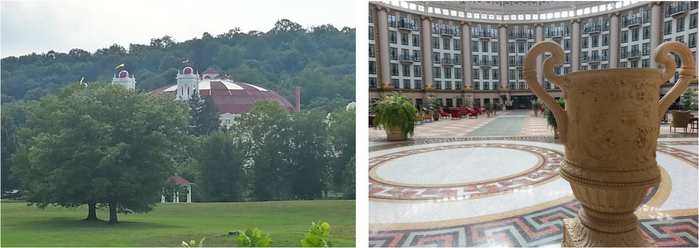
Nashville, where I would spend the night. I have never been to Nashville, so earlier that day I did what all tourists are supposed to do: bought a ticket to the Grand Ole Opry, booking a room in one of the many motels nearby.  It finally stopped raining about the time I pulled into the motel.   

I have never been a big fan of Country Music, and seeing the show at the Grand Ole Opry did not really change that.  But it was really great.  For those who don’t know (which included me, up until a day or two ago), one does not see a singer or band at the Grand Ole Opry; it is a sort-of Country sampler, with eight different acts – each of which gets exactly three songs.  (This was a Wednesday night; the format is a bit longer on Fridays and Saturdays.)  There are some old folks who sing songs from their primes back in the sixties, some current stars, and some new up-and-comers. The eight acts I saw were: Bill Anderson; Holly Williams [daughter of Hank Williams Jr and thus granddaughter of you-know-who]; Del McCoury Band; Lorrie Morgan; Wade Hayes; The Quebe Sisters (reminded me of the Andrews Sisters); Drake White, and Mel Tillis.  I had not heard of any of them (although I confess I should have known Mel Tillis), and I did not know any of the songs except “Wichita Lineman. 

What impressed me most about the performance was: the business model. One key concept, which goes back 70 years, is that this is a radio show – starting back when radio was new, and continuing now on Sirius XM.  If you got on the show as a guest, it helped your career. The second key concept is the idea of musician membership.  If nominated, you could become a semi-regular on the radio shows, which would keep you in the spotlight even if you hadn’t had a hit in a while.  However, in order to become a member, the artist must agree to do a certain number of performances (three songs only!) per year, something like 20 or 30.  Grand Ole Opry thus becomes a hybrid of Las Vegas, Saturday Night Live, and A Prairie Home Companion.  Importantly, by deciding who gets offered membership (and who gets invited to play as a guest), the management gets something over the genre of Country Music that I don’t think any other genre has: Configuration Control.  OK, we’ll allow those “longhair” electric guitars and even occasional drums, but there will be none of this “new wave” or “punk” or “alternative” stuff.  Very impressive, to my mind.

Here is another thing.  The requirement for “members” to play 20 + nights a year in Nashville means that it becomes advantageous to live there, which in turn makes it an attractive place to come for other aspiring musicians looking to work as session players.  This, in turn, makes it an attractive place for singer-songwriters to come, since lots of session musicians are already there to help you record your songs.  Thus, I suspect, Nashville came to be the center of the Country Music Universe, rather than Memphis, or Atlanta, or New York, or Los Angeles. 

Not all musicians like this; I remember that Waylon and Willie and Merle were “outlaws,” not because they sang songs about Billy the Kid, but because they did not like being constrained by the Nashville sound and wouldn’t cooperate.  I don’t know how connected the Grand Ole Opry is to the rest of the Nashville music business, but I remember the Indigo Girls singing the line “I sing what I still own” in their song “Nashville.” 

One more thing: I believe that every single member of the audience was from out of town. My evidence for this is that one of the performers asked “Who here is from Nashville?” and got dead silence for a reply.  This probably explains a couple other things.  One performer made a big point out of wishing to thank every single member of the Armed Forces for their Service to America – and got only polite applause instead of the roar I think he was expecting.  It might have been the same guy who earlier said “I have a real problem with the way this country is headed” – and got a puzzled, half-hearted, “what, specifically, do you mean?” kind of reaction to what I guess he thought was red meat.  Not their usual audience.  All in all, a fascinating evening; I am very glad I went. 

Left: Outside, before the show.  Right. Inside, with the giant TV in the Barn as the stage backdrop.  That's Mel Tillis.

Thursday (August 6) it basically rained all day.  I took I-40 instead of US-70 east, and then the still-large TN 111 northeast to the border with Kentucky. Once across the border, I took US 27 – a very nice two-laner – to Russell Springs, and then KY80 east to the town of Somerset, where I am now.  I am in that part of Somerset that is all motels and fast food joints, and with all the rain I didn’t get to see much of the surrounding scenery.  But the temperature was nice, in the high 70’s, good for riding even when you’re wet (as I eventually became).  I’m not a big fan of wet socks.


Typical view from today.  Central Tennessee. 

Tuesday, August 4, 2015

Day 82 (August 4). Into Southern Indiana

From: Springfield, IL
To: French Lick, IN
Miles today: 255
Total miles: 16778

As I rode southeast across Illinois and into Indiana along IL 29, US 51 south and good old US 50 east, it threatened to rain all day.  Not the afternoon thunderstorms of elsewhere, but the all-day type associated with the eastern US.  I am almost home. 

But it didn’t rain, and while muggy, the overcast held the temperatures down to the mid-80’s.  The land is not quite flat, and everywhere is either crops or hardwood forest.  As I moved further south, toward the Ohio river valley, small areas of marsh or swamp appeared.  This kind of terrain reminds me of where I was a kid in Monmouth County, New Jersey, before it got completely developed. I used to walk or ride my bike with friends all over area like this, or be driven through it in my dad’s VW Beetle. 

Southern Illinois.  Left: The intersection of US 50 and US 51 had to be somewhere -- it turns out it is in Sandoval, IL.
Right: Typical view of the entire region: corn, grasses, trees.

Once I crossed the Wabash River and into Indiana, and got a bit further south, the famous limestone outcroppings this area is famous for began to appear. I look forward to exploring them in more detail tomorrow.  Meanwhile, I headed for the town of French Lick, where I was once many years ago.  This was a resort town from the late 19th century up until 1929 due to their “Pluto Water,” or natural mineral springs.  I remember coming across a gigantic domed resort building when I was here before, and thinking what a shame it was that such a magnificent, opulent structure was falling into ruins.  Well, since then someone decided to invest a ton of money into this area (it is about halfway between Indianapolis and Louisville), and the building has been completely refurbished and re-opened as the pricy West Baden Springs Hotel.  I had to go inside, which fortunately is allowed even if you are not a guest.  The rooms are in a circular ring around a 200-foot diameter atrium, with the windows and balconies looking down into it.  I had already booked a room, and it was really expensive, but I was sorely tempted to spend the night there.  It is lovely.

Refurbished West Baden Springs Resort, now a luxury hotel.  Left: exterior view from the road.  Right: interior shot of the huge atrium.  In the distance are three levels of hotel rooms.  I think the floor tiling is original, or a good restoration. 


Unfortunately, they found lithium in the mineral springs themselves, so you can no longer bathe in the water or drink it.  Lithium is toxic, but in small doses it is known as a powerful anti-depressant.  Perhaps that was the true reason people liked this resort so much the first time around!

Day 81 (August 3). Springfield, IL

Miles today: 0

Today is Monday, August 3, the first day of Sturgis.  Google Maps tells me I am 966 miles away.  For the most part, I am glad!

I took another needed day off today.  I slept most of the morning, did some laundry, and finally got out to explore downtown at around 3 pm.  I resisted the urge to go to the Abraham Lincoln Presidential Museum, instead opting for the Illinois State Museum (both were walking distance).   I am really glad I did.

Large museums, I find, tend to come in one of two styles. The older one, less common now, is a vast display of interesting collected objects.  These objects are always identified, but it is up to the viewer to determine their significance. The Black Hills Institute museum I visited in Hill City, South Dakota, was of this format. The other style, which has largely taken over since I was a kid, is one of story-teller. It tends to display a much smaller number of objects, but arranges what it has with informative descriptions that it expects (or at least hopes) the viewer will read, and follow from one display to the next. The Illinois State Museum is of this format, and it does it as well as I’ve seen.  The unofficial theme is “What happened in the past to make Illinois, Our Home State, what it is today?”  The natural history exhibits identify not just where North America was at each major era (Devonian, Jurassic, Ice Age, etc.), but where specifically Illinois was.  Then it shows fossils from that era, collected from Illinois. 

Natural History section, Illinois State Museum.  Both photos are of one display. Left: I like how they show where Illinois was during this era.  Right: All fossils are from Illinois.  

Other exhibits discussed anthropology in a similar way – what aboriginals were here, along with displays of artifacts as well as the occasional diorama.  The focus on the coming of the European settlers was also treated in this way. I especially enjoyed the exhibit on how people in the state dealt with the turmoil of the 1960s, and how different generations if Illinoisans view the world.  I thought the whole thing was first rate.  I told this to the guy at the front desk, and another visitor told me that the Governor was trying to close this very museum due to a large budget shortfall.


Hilarious modern anthropology.  Left: Very reminiscent of the houses I knew in New Jersey in the 1960's, including the futuristic wire art.  Right.  Teenagers room from that era -- love it!  P.S. Note the anachronism on the right. Third object down on the closet door is "Rites of Passage" by the Indigo Girls, released 1992.  I know because I own it (on CD)!

After the museum, I walked about six blocks to the house Abraham Lincoln lived in for 20+ years, when he worked as a lawyer and eventually ran for President. Springfield has restored four blocks of houses around it, with gravel streets and plank sidewalks.  It is a bit like Williamsburg, Virginia, except that there are no re-enactors.  While Lincoln’s house itself is no Mount Vernon, it is really a very nice house in a nice middle-class neighborhood – a far cry from the log cabin of lore.  Then dinner in a brewpub located in a converted house of the same era (1830’s). All in all, a really nice day off from riding.


Left: Map of "Lincoln's Neighborhood," Springfield IL.  Right: Lincoln's home for many years.

Sunday, August 2, 2015

Day 80 (August 2). Midwest Interstate

From: Bethany, MO
To: Springfield, IL
Miles today: 296
Total miles: 16523

OK, here is one nice thing about the scenery in this region: they have great clouds, often with striking results at sunset. Here is the view over my motel parking lot last evening.

Thunderhead at sunset over my motel in Bethany, Missouri

I left Bethany, MO, this morning on the small road MO 13 south, in order to get to US 36 and across Missouri. This was a pleasant two-lane road, and I enjoyed the ride.  But it was muggy, and the temperature was already in the high 80’s. I knew when I planned this trip that I would be end would involve this kind of weather – it is August, and I live in Virginia – and those chickens are now roosting. 

Roadside view of northwest Missouri (north of Kansas City) from Route MO 13.

I had hoped that US 36 would be more two-lane, like US 34 had been yesterday, but it turned out to be four-lane divided highway – essentially Interstate.  You don’t see much from these roads, but oh well.  I hauled across Missouri in the heat and humidity, cruising at about 70 (the posted speed limit), and pulled into Hannibal around 2 pm. Diana and I had been here in 2009, when we were looking at colleges for her to attend, and the place looked exactly the same.  It is the boyhood home of Mark Twain, and a major part of the town is set up to celebrate this fact.  For me, though, the key feature is that Hannibal is on the Mississippi River, which I crossed shortly thereafter.

The required Mark Twain Steamboat in Hannibal, Missouri.  That's the Mississippi River.

After another hundred miles of Interstate (I-72 – official this time), I arrived in Springfield, Illinois. I found an affordable hotel in the downtown section (this is a pretty big city, with a lot of sprawl), and looked forward to a walk around in the evening when things cooled off.  I did this, and what I saw seemed quite nice (see the pix below).  But there was something odd – almost no people!  I had been in other cities where the downtown emptied out at night, but the buildings there were all hi-rises. There were large sections of neighborhood here that looked like there ought to be hundreds of people out for an evening stroll, or a bite or a drink, but there were not.  Granted, this is a Sunday evening, but still, it struck me as odd. I also have the feeling that I am the only guest tonight in this fairly large downtown hotel. 

Downtown Springfield, Illinois, at 8 pm on a Sunday evening.  Nice, but no people!

After finally finding an open food joint, on my return walk, one of the few locals out saw me looking around and half-muttered, “If you are a tourist, what the heck are you doing in Springfield?”  I chose to engage – “Why, I’ve never been here.”  He went on to say that all they had was “Lincoln this, Lincoln that,” and lamented that they drummed this into everyone all the time. At one point, after I made a comment about the TV show “The Simpsons,” he quickly informed me that the legend that every state had a town called Springfield in it was false; there are only seven such states. 


Of course, there is something in Springfield – it is the State Capitol.  But what I think may be missing from this town is a major university.  U of I has a branch here, the former Sangamon State University, but it fairly small and on the outskirts.  There are two private colleges as well, but the big university towns in Illinois are Chicago and Champaign-Urbana. I think Springfield feels this absence. 

Saturday, August 1, 2015

Day 79 (August 1). Iowa and vicinity

From: Grand Island, NE
To: Bethany, MO
Miles today: 327
Total miles: 16227

Route US 34 east.  That was pretty much my day today.  I took it from Grand Island, Nebraska, over the Platte River, a prototypical example of a “braided river.” It is shallow with lots of sand bars, the way it has been for thousands of years. 

The Platte River - wide and shallow.  

About an hour later, I crossed the Missouri River and entered Iowa.  I wanted to get a picture of the Missouri also, but the bridge was long and there was no good place to stop.  This river is deeper and swifter.  The Platte flows into the Missouri a few dozen miles south of Omaha, but the area is marshy and there is no town there.

I continued on US 34 through Iowa for a long time. The terrain was rolling, and there were more trees than I expected, but it was pretty much all corn fields with some hay and pasture land thrown in.  The road passed through or by a number of small towns, but nothing grabbed my attention.  Is it me?  Am I finally just tired after all these weeks on the road? Or is there really nothing much to see here?  I feel bad just writing this.  I thought about a side trip to Des Moines, but in a web search I couldn’t find anything more interesting there than the birthplace of John Wayne, so I just kept going.  I got to I-35 and took it south into Missouri, where I am now.  Tomorrow I head east again, toward Hannibal, and then Springfield, Illinois. 

Iowa.  From what I can tell, this pretty much sums it up.

Friday, July 31, 2015

Day 78 (July 31). Sand Hills, Nebraska

From: Alliance, NE
To: Grand Island, NE
Miles today: 278
Total miles: 15900

Many years ago on one transcontinental flight or another, l looked out the window and saw a vast array of what appeared to be sand dunes.  In the middle of the US!  Later I researched the subject, and determined that what I saw was the Sand Hills region of Nebraska.  That image has always stuck with me, and I vowed that if I were ever in western Nebraska, I would go and see what this place looked like at eye level.  My opportunity has arrived!

Sand Hills of Nebraska. Left: from space (Google Maps).  Right: View from Route NE 2.

The Sand Hills region of Nebraska is recognized as a separate ecological region within the Great Plains.  It is essentially a region of large sand dunes that have been locked in place by the same types of grasses that grow in the surrounding regions.  This freezing of the dunes seems to be a recent development; as recently as 1000 years ago (during the Medieval Warm Period, according to Wikipedia), these dunes were “active,” meaning they moved around and buried anything that got in their way.  I examined the terrain up close, and even dug into it a little.  Yep, this is sand, loose sand, just like on the beach. If the plants go away, the dunes become active again. 

The Sand Hills are just that -- dunes with grass.

In addition to the dunes themselves, there are lots of small ponds in low-lying areas. This is because the Sand Hills sit atop the much larger Ogallala Aquifer, so instead of sinking into the depths of the earth, much of the water can stay at the surface.  In return, these ponds apparently recharge the aquifer, which provides drinking water for many of the residents that sit over it.  The sandy nature of the soil has always made it unsuitable for agriculture (although as grassland it supports cattle fairly well).  As a result, most of this land has never been plowed, making it almost unique in its “pristine-ness” in the Midwest. Not a lot of people live out here, but Route NE 2 runs right through the middle of it.  I am glad I took the opportunity to see it.

Left: Map of the Sand Hills.  Right: Map of the Ogallala Aquifer. 


Ponds are common in the Sand Hills, as are cattle (and trains!)


Somewhere near the town of Broken Bow, the Sand Hills peter out and we are back to the Great Plains.  Corn and cattle, and a lot of both.   Amidst the rising of some gigantic thunderheads, I pulled into the town of Grand Island.  (The name comes from an island in the Platte River, but the “town” moved to the north shore when the railroad came through.)  Before hitting the motel, I took an hour or so and toured some of the Stuhr Museum of Pioneer History, which is one of the more famous museums in Nebraska. 

The Stuhr Museum sits on a large chunk of land on the south end of town.  The main building is beautiful, but mostly empty; many of the actual exhibits are a small number of donated items, including clothes and weapons of the period, as well as a replica of a Conestoga wagon.  Around the central building are a number of sites where volunteers in period costume show you what it was like at various times.  Only some of these times are associated with the pioneer age, however; there is a lot of emphasis on the coming of the railroads.  What I figured out is the land itself is the most important thing about the place. There are wagon ruts on the grounds from the pioneer days, as thousands of people moved west along the Platte River on the Oregon Trail and other routes.  That was pretty cool.


The Stuhr Museum.  Left: the main building - beautiful architecture outside and in, but limited gallery space.  Right: ruts left by  Conestoga wagons over a century ago.  

Thursday, July 30, 2015

Day 77 (July 30). Black Hills

From: Hill City, SD
To: Alliance, NE
Miles today: 160
Total miles: 15622

I took some of the “back roads” through the southern part of the Black Hills region this morning (SD 87 & 89), along with several hundred Harley riders.  One thing I really like about Harley riders is they take the curves slow – even the speed limit.  These were very twisty roads, and this not only induced less stress for me, but it gave me more time to look around at the scenery.  I stopped often to look at the rocks up close as well.  The view from these back roads is a bit different from other places I’ve been – there are pine trees, but they are not dense, and there is little undergrowth. You can’t see through them very well, but it does give you a feeling of openness. The rock formations in the center of the park are pretty wild, almost unworldly.  These are ancient rocks, mostly granite but with lots of other things mixed in.  The entering and then freezing of water into the minute cracks create these odd shapes.

View from SD 8 in the Black Hills, South Dakota

The ancient rocks often tower over the road.
There are many smaller outcroppings as well.
Further south, one gets out of the igneous region and into the younger sedimentary rocks that surround it. There are lots of limestone caves around here. The forces at work have made this place a rock hound’s dream; fist-size chunks of quartz next to agates and other stones of many colors just lying by the road.  Here is a picture of “rainbow limestone” (I’m sure that is not its real name, but it seems reasonable to call it that).  This is just a road cut.

"Rainbow limestone."  I have no idea what causes this effect. 


At the town of Custer, I picked up US 385 south and took it out of the park and out of South Dakota and into Nebraska. At a  break in the town of Chadron, I noticed a Honda shop and took the opportunity to see if they could change my oil, something that has been overdue. They were great and did it in about half an hour.  I continued south and called it a day in Alliance, NE.  Tomorrow I will ride through the Sand Hills of Nebraska, a unique ecosystem that covers about a quarter of the state.  

Wednesday, July 29, 2015

Day 76 (July 29). TBNG, BHIM, and Hill City

From: Bill, WY
To: Hill City, SD
Miles today: 160
Total miles: 15462

What a weird, strange day. 

Things started out normally.  As I had hoped, the wind had died down to almost nothing in the morning.  I rode the 100 plus miles north on WY 59 and then east on WY 450 to Newcastle, Wyoming, through Thunder Basin National Grassland.  I’m not sure what is “national” about it, since there were fences, cows, trains, and even a large open-pit coal mine along the way, but the scenery was great.  As was the calm air. 

Thunder Basin National Grassland, in the high plains of Wyoming.

Newcastle is at the edge of the Black Hills, so after getting on US 16 I quickly left the grasslands behind.  The Black Hills are a geologist’s dream; there was an upwelling in the center, followed by erosion, so the rocks toward the middle are very old while the ones on the edges are younger, in actual concentric “rings.”  The rocks in the middle, which are what Mount Rushmore is carved out of, are Precambrian, and in fact some of the oldest exposed rocks in North America. 

Precambrian rocks in the center of the Black Hills.  Mount Rushmore is carved out of this stuff.

My goal was to reach Hill City, across the border in South Dakota.  That is where the famous (to us dinosaur fans, anyway) Black Hills Institute is located.  Many famous scientists have worked here, and this is sort of “ground zero” for expertise in the Hell’s Creek Formation, where many of the world’s most impressive dinosaur fossils have been unearthed.  They have a museum that is open to the public, so I figured I had to go; in fact it was my justification to myself for turning north again, after I was in Colorado. 

Well, let me tell you, the place was not what I expected.  I think I was looking for a shrine of sorts, a quietly reverent presentation of the efforts of great men uncovering deep and amazing truths about Earth’s past, and the nature of life itself.  What I found was a three-ring circus.  The building is divided into large two rooms of roughly equal size.  One is the gift shop, about which I’ll say more in a minute.  The other is the museum itself, which is so crammed full of fossils that it is actually difficult to walk through.  In the center are the dinosaur skeletons, most of which are real and unearthed in the western US by people who work at the institute.  (There are signs that say “Please don’t touch the bones,” but it is almost impossible not to because they are everywhere!)  It looks like every time they finished reassembling another dinosaur skeleton, they would just find some place in between the others to wedge it. 

Along the walls are cabinet after cabinet of absolutely amazing invertebrate fossils.  Most of these fossils were not from the area or the Hell’s Creek Formation, but from all over the world, much as my own small collection is.  That is what this is: it is the personal collection of the guys who are operating the museum!  They have a ton of stuff and they are going to display every last bit of it.  They don’t mind using pegboard to hold the stuff. They don’t mind that it makes them seem like they ought to be on an episode of the TV show “hoarders.”  Did I mention that the fossils themselves were amazing? 

The Black Hills Institute Museum.  Left: the center of the room. Right: cabinets like this all the way around.

World class fossils -- displayed on pegboard!  On the right is a feathered dinosaur from China, truly priceless. Except that the guys that run the museum apparently bought it, or traded dinosaur fossils for it.

Honestly, how many T. Rex skulls does one actually need? These are placed on top of the cabinets seen above, near the ceiling, because there is no room for them anywhere else. 

Then there is the gift shop.  Here you could buy anything from a T-shirt or a fake road sign that reads “Cretaceous Place” to nearly complete fossil vertebrates (mostly mammals, not dinosaurs).  They were selling not only their own fossils but anyone and everyone else’s; trilobites from Morocco, ammonites from Madagascar, and rock and mineral samples from all over the world.  I asked the woman working there if there was a book of pictures of the exhibits; she said no, but it was on the to-do list.  Somehow that fit perfectly.

BHI Museum gift shop.  Left: We got your T-shirts and jewelry.
Right: Want a real fossil mammal skeleton?  $7500 and it's yours.  We ship!  

Oh, one more thing about my day. I had actually restructured my trip a bit so that I would not be in South Dakota during the week that is “Sturgis.”  For those who don’t know, this is the biggest motorcycle rally in the country, lasting seven days and starting next week (Monday, August 3).  It takes place in the town of Sturgis, near Rapid City, SD, about 60 miles away from Hill City.  It is mostly a celebration of the Harley-Davidson Lifestyle, and since I am not a Harley rider, I had no desire to go.  But this is the 75th such rally, and apparently it is a really big deal.  I heard a couple of different people say they expect over a million people this year.  (A smart guy in Sturgis bought a huge area of land several years ago that he has turned into a campground, and this is apparently where most people stay, since there is no way the hotel infrastructure can support it.)  It has gotten so big that it has taken over the entire Black Hills region, including Hill City, and apparently people arrive early (in order to get a good tent spot?).  So: Hill City is jam packed with motorcycles, mostly Harleys.  When one finds oneself in Rome, despite having tried to avoid Rome, all one can really do is hang out with the bikers.  I had a great time admiring their bikes and drinking beer in their bars, but I didn’t get a chance to talk to them at length since they all tended to be in groups.  I had formulated a question, something like this:  “I get that owning and riding a Harley is making a statement.  What I don’t understand is what that statement is.  Could you explain it to me?”  Alas, I did not get the chance. But everyone was very nice.  Most of these bikers are now a bit long in the tooth.  Anyway, when people ask me now if I have ever been “to Sturgis,” I can truthfully reply, “sort of.”  I think that’s enough.

Pre-Sturgis festivities in Hill City, South Dakota.  On the right is the "Mangy Moose," where I had a couple of beers amongst the Harley-ites.


Honda among the Harleys.  I have no chrome. 


Tuesday, July 28, 2015

Day 75 (July 28). Eastern Wyoming

From: Laramie, WY
To: Bill, WY
Miles today: 173
Total miles: 15302

I left Laramie on US 287 north, and after about 25 miles branched off onto the much smaller WY 34.  This route turned out to be great for two reasons.  The first was that it was quite scenic; it twisted its way through a range of low hills (not really mountains), which look quite different than most of the high plains in this region.  The second is that those hills provided some protection against the wind.  It was very empty, and I cruised along at a relaxed speed and enjoyed the ride.

Panorama shot of WY 34 roadside

All good things must end, and WY 34 dumped me into I-25, which I took north to the town of Douglas.  The speed limit here was 80 mph, and while the road itself was pretty straight, those crosswinds kept me well below that limit.  Fortunately it was divided highway, so the big trucks could easily get around me.  At Douglas, I turned north on WY 59, a route that runs through Thunder Basin National Grassland (TBNG), one of the reasons I am in Wyoming.  As the afternoon wore on, the winds got even fiercer, and traffic was a lot heavier on this two-lane road than it was on WY 34 this morning.  A lot of vehicles passed me (all with four or more wheels). I did see, on this road, an 18-wheeler in a ditch being tended to by some large tow trucks.  No curves on that stretch; I really think it was the wind that did it.  It was that strong.

Windy!

Mentally as well as physically fatigued by this battle, I pulled off into the town of Bill, Wyoming, at the south end of the TBNG.  Bill is composed of a very nice truck stop and nothing else.  (My room is a lot better than the one I had in Laramie, and the diner is open 24 hours!)  I am hoping that the winds will be calmer in the morning, which will give me a better chance of enjoying TBNG.  From there I will head east to the Black Hills of South Dakota.


Big Sky.  What much of eastern Wyoming looks like.