Friday, July 31, 2015

Day 78 (July 31). Sand Hills, Nebraska

From: Alliance, NE
To: Grand Island, NE
Miles today: 278
Total miles: 15900

Many years ago on one transcontinental flight or another, l looked out the window and saw a vast array of what appeared to be sand dunes.  In the middle of the US!  Later I researched the subject, and determined that what I saw was the Sand Hills region of Nebraska.  That image has always stuck with me, and I vowed that if I were ever in western Nebraska, I would go and see what this place looked like at eye level.  My opportunity has arrived!

Sand Hills of Nebraska. Left: from space (Google Maps).  Right: View from Route NE 2.

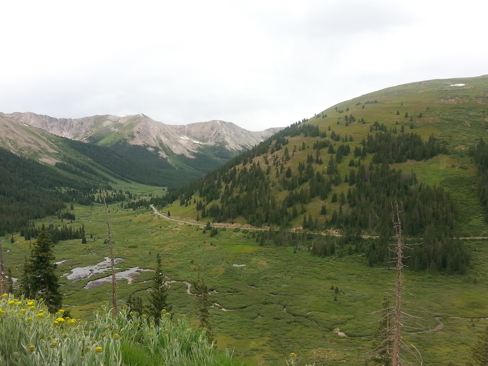
The Sand Hills region of Nebraska is recognized as a separate ecological region within the Great Plains.  It is essentially a region of large sand dunes that have been locked in place by the same types of grasses that grow in the surrounding regions.  This freezing of the dunes seems to be a recent development; as recently as 1000 years ago (during the Medieval Warm Period, according to Wikipedia), these dunes were “active,” meaning they moved around and buried anything that got in their way.  I examined the terrain up close, and even dug into it a little.  Yep, this is sand, loose sand, just like on the beach. If the plants go away, the dunes become active again. 

The Sand Hills are just that -- dunes with grass.

In addition to the dunes themselves, there are lots of small ponds in low-lying areas. This is because the Sand Hills sit atop the much larger Ogallala Aquifer, so instead of sinking into the depths of the earth, much of the water can stay at the surface.  In return, these ponds apparently recharge the aquifer, which provides drinking water for many of the residents that sit over it.  The sandy nature of the soil has always made it unsuitable for agriculture (although as grassland it supports cattle fairly well).  As a result, most of this land has never been plowed, making it almost unique in its “pristine-ness” in the Midwest. Not a lot of people live out here, but Route NE 2 runs right through the middle of it.  I am glad I took the opportunity to see it.

Left: Map of the Sand Hills.  Right: Map of the Ogallala Aquifer. 


Ponds are common in the Sand Hills, as are cattle (and trains!)


Somewhere near the town of Broken Bow, the Sand Hills peter out and we are back to the Great Plains.  Corn and cattle, and a lot of both.   Amidst the rising of some gigantic thunderheads, I pulled into the town of Grand Island.  (The name comes from an island in the Platte River, but the “town” moved to the north shore when the railroad came through.)  Before hitting the motel, I took an hour or so and toured some of the Stuhr Museum of Pioneer History, which is one of the more famous museums in Nebraska. 

The Stuhr Museum sits on a large chunk of land on the south end of town.  The main building is beautiful, but mostly empty; many of the actual exhibits are a small number of donated items, including clothes and weapons of the period, as well as a replica of a Conestoga wagon.  Around the central building are a number of sites where volunteers in period costume show you what it was like at various times.  Only some of these times are associated with the pioneer age, however; there is a lot of emphasis on the coming of the railroads.  What I figured out is the land itself is the most important thing about the place. There are wagon ruts on the grounds from the pioneer days, as thousands of people moved west along the Platte River on the Oregon Trail and other routes.  That was pretty cool.


The Stuhr Museum.  Left: the main building - beautiful architecture outside and in, but limited gallery space.  Right: ruts left by  Conestoga wagons over a century ago.  

Thursday, July 30, 2015

Day 77 (July 30). Black Hills

From: Hill City, SD
To: Alliance, NE
Miles today: 160
Total miles: 15622

I took some of the “back roads” through the southern part of the Black Hills region this morning (SD 87 & 89), along with several hundred Harley riders.  One thing I really like about Harley riders is they take the curves slow – even the speed limit.  These were very twisty roads, and this not only induced less stress for me, but it gave me more time to look around at the scenery.  I stopped often to look at the rocks up close as well.  The view from these back roads is a bit different from other places I’ve been – there are pine trees, but they are not dense, and there is little undergrowth. You can’t see through them very well, but it does give you a feeling of openness. The rock formations in the center of the park are pretty wild, almost unworldly.  These are ancient rocks, mostly granite but with lots of other things mixed in.  The entering and then freezing of water into the minute cracks create these odd shapes.

View from SD 8 in the Black Hills, South Dakota

The ancient rocks often tower over the road.
There are many smaller outcroppings as well.
Further south, one gets out of the igneous region and into the younger sedimentary rocks that surround it. There are lots of limestone caves around here. The forces at work have made this place a rock hound’s dream; fist-size chunks of quartz next to agates and other stones of many colors just lying by the road.  Here is a picture of “rainbow limestone” (I’m sure that is not its real name, but it seems reasonable to call it that).  This is just a road cut.

"Rainbow limestone."  I have no idea what causes this effect. 


At the town of Custer, I picked up US 385 south and took it out of the park and out of South Dakota and into Nebraska. At a  break in the town of Chadron, I noticed a Honda shop and took the opportunity to see if they could change my oil, something that has been overdue. They were great and did it in about half an hour.  I continued south and called it a day in Alliance, NE.  Tomorrow I will ride through the Sand Hills of Nebraska, a unique ecosystem that covers about a quarter of the state.  

Wednesday, July 29, 2015

Day 76 (July 29). TBNG, BHIM, and Hill City

From: Bill, WY
To: Hill City, SD
Miles today: 160
Total miles: 15462

What a weird, strange day. 

Things started out normally.  As I had hoped, the wind had died down to almost nothing in the morning.  I rode the 100 plus miles north on WY 59 and then east on WY 450 to Newcastle, Wyoming, through Thunder Basin National Grassland.  I’m not sure what is “national” about it, since there were fences, cows, trains, and even a large open-pit coal mine along the way, but the scenery was great.  As was the calm air. 

Thunder Basin National Grassland, in the high plains of Wyoming.

Newcastle is at the edge of the Black Hills, so after getting on US 16 I quickly left the grasslands behind.  The Black Hills are a geologist’s dream; there was an upwelling in the center, followed by erosion, so the rocks toward the middle are very old while the ones on the edges are younger, in actual concentric “rings.”  The rocks in the middle, which are what Mount Rushmore is carved out of, are Precambrian, and in fact some of the oldest exposed rocks in North America. 

Precambrian rocks in the center of the Black Hills.  Mount Rushmore is carved out of this stuff.

My goal was to reach Hill City, across the border in South Dakota.  That is where the famous (to us dinosaur fans, anyway) Black Hills Institute is located.  Many famous scientists have worked here, and this is sort of “ground zero” for expertise in the Hell’s Creek Formation, where many of the world’s most impressive dinosaur fossils have been unearthed.  They have a museum that is open to the public, so I figured I had to go; in fact it was my justification to myself for turning north again, after I was in Colorado. 

Well, let me tell you, the place was not what I expected.  I think I was looking for a shrine of sorts, a quietly reverent presentation of the efforts of great men uncovering deep and amazing truths about Earth’s past, and the nature of life itself.  What I found was a three-ring circus.  The building is divided into large two rooms of roughly equal size.  One is the gift shop, about which I’ll say more in a minute.  The other is the museum itself, which is so crammed full of fossils that it is actually difficult to walk through.  In the center are the dinosaur skeletons, most of which are real and unearthed in the western US by people who work at the institute.  (There are signs that say “Please don’t touch the bones,” but it is almost impossible not to because they are everywhere!)  It looks like every time they finished reassembling another dinosaur skeleton, they would just find some place in between the others to wedge it. 

Along the walls are cabinet after cabinet of absolutely amazing invertebrate fossils.  Most of these fossils were not from the area or the Hell’s Creek Formation, but from all over the world, much as my own small collection is.  That is what this is: it is the personal collection of the guys who are operating the museum!  They have a ton of stuff and they are going to display every last bit of it.  They don’t mind using pegboard to hold the stuff. They don’t mind that it makes them seem like they ought to be on an episode of the TV show “hoarders.”  Did I mention that the fossils themselves were amazing? 

The Black Hills Institute Museum.  Left: the center of the room. Right: cabinets like this all the way around.

World class fossils -- displayed on pegboard!  On the right is a feathered dinosaur from China, truly priceless. Except that the guys that run the museum apparently bought it, or traded dinosaur fossils for it.

Honestly, how many T. Rex skulls does one actually need? These are placed on top of the cabinets seen above, near the ceiling, because there is no room for them anywhere else. 

Then there is the gift shop.  Here you could buy anything from a T-shirt or a fake road sign that reads “Cretaceous Place” to nearly complete fossil vertebrates (mostly mammals, not dinosaurs).  They were selling not only their own fossils but anyone and everyone else’s; trilobites from Morocco, ammonites from Madagascar, and rock and mineral samples from all over the world.  I asked the woman working there if there was a book of pictures of the exhibits; she said no, but it was on the to-do list.  Somehow that fit perfectly.

BHI Museum gift shop.  Left: We got your T-shirts and jewelry.
Right: Want a real fossil mammal skeleton?  $7500 and it's yours.  We ship!  

Oh, one more thing about my day. I had actually restructured my trip a bit so that I would not be in South Dakota during the week that is “Sturgis.”  For those who don’t know, this is the biggest motorcycle rally in the country, lasting seven days and starting next week (Monday, August 3).  It takes place in the town of Sturgis, near Rapid City, SD, about 60 miles away from Hill City.  It is mostly a celebration of the Harley-Davidson Lifestyle, and since I am not a Harley rider, I had no desire to go.  But this is the 75th such rally, and apparently it is a really big deal.  I heard a couple of different people say they expect over a million people this year.  (A smart guy in Sturgis bought a huge area of land several years ago that he has turned into a campground, and this is apparently where most people stay, since there is no way the hotel infrastructure can support it.)  It has gotten so big that it has taken over the entire Black Hills region, including Hill City, and apparently people arrive early (in order to get a good tent spot?).  So: Hill City is jam packed with motorcycles, mostly Harleys.  When one finds oneself in Rome, despite having tried to avoid Rome, all one can really do is hang out with the bikers.  I had a great time admiring their bikes and drinking beer in their bars, but I didn’t get a chance to talk to them at length since they all tended to be in groups.  I had formulated a question, something like this:  “I get that owning and riding a Harley is making a statement.  What I don’t understand is what that statement is.  Could you explain it to me?”  Alas, I did not get the chance. But everyone was very nice.  Most of these bikers are now a bit long in the tooth.  Anyway, when people ask me now if I have ever been “to Sturgis,” I can truthfully reply, “sort of.”  I think that’s enough.

Pre-Sturgis festivities in Hill City, South Dakota.  On the right is the "Mangy Moose," where I had a couple of beers amongst the Harley-ites.


Honda among the Harleys.  I have no chrome. 


Tuesday, July 28, 2015

Day 75 (July 28). Eastern Wyoming

From: Laramie, WY
To: Bill, WY
Miles today: 173
Total miles: 15302

I left Laramie on US 287 north, and after about 25 miles branched off onto the much smaller WY 34.  This route turned out to be great for two reasons.  The first was that it was quite scenic; it twisted its way through a range of low hills (not really mountains), which look quite different than most of the high plains in this region.  The second is that those hills provided some protection against the wind.  It was very empty, and I cruised along at a relaxed speed and enjoyed the ride.

Panorama shot of WY 34 roadside

All good things must end, and WY 34 dumped me into I-25, which I took north to the town of Douglas.  The speed limit here was 80 mph, and while the road itself was pretty straight, those crosswinds kept me well below that limit.  Fortunately it was divided highway, so the big trucks could easily get around me.  At Douglas, I turned north on WY 59, a route that runs through Thunder Basin National Grassland (TBNG), one of the reasons I am in Wyoming.  As the afternoon wore on, the winds got even fiercer, and traffic was a lot heavier on this two-lane road than it was on WY 34 this morning.  A lot of vehicles passed me (all with four or more wheels). I did see, on this road, an 18-wheeler in a ditch being tended to by some large tow trucks.  No curves on that stretch; I really think it was the wind that did it.  It was that strong.

Windy!

Mentally as well as physically fatigued by this battle, I pulled off into the town of Bill, Wyoming, at the south end of the TBNG.  Bill is composed of a very nice truck stop and nothing else.  (My room is a lot better than the one I had in Laramie, and the diner is open 24 hours!)  I am hoping that the winds will be calmer in the morning, which will give me a better chance of enjoying TBNG.  From there I will head east to the Black Hills of South Dakota.


Big Sky.  What much of eastern Wyoming looks like.

Day 74 (July 27). RMNP & Laramie

From: Georgetown, CO
To: Laramie, WY
Miles today: 220
Total miles: 15129

With the Colorado equivalent of “beach traffic” cleared out, it was an easy trip on I-70 east to US 40 west, which starts west and then turns north.  (To go north around here you have to go sideways a lot).   US 40 rises and falls over another pass going north, and by this time I had lost track of which side of the continental divide I was on.  Just past the town of Granby, US 34 east breaks off (due north!).  This is one of two roads that takes you through Rocky Mountain National Park (RMNP), and clearly the more popular one. I didn’t really appreciate this until today, but RMNP isn’t someplace you go, like Yellowstone or the Grand Canyon, but rather someplace you drive through; US 34 is that route. No trucks are allowed on this route, but the tourist traffic was very heavy.  It is well-managed, however; there are lots of roadside pullouts to take pictures at, as well as to get out of the way if the line of cars behind you is too long.  On the whole I estimate that the traffic moved at about 40 mph. 

At one of my many stops along this route as I climbed and climbed, I came across a nice view of a “tree line” or a “timber line.”  For those who haven’t seen one, there is an altitude on high mountains where trees can’t grow anymore due to cold or other conditions.  It is not a true “line,” of course, but it is a lot more abrupt than you might think.  Here is a photo.

The Tree Line.  US 34, Rocky Mountain National Park, Colorado.

I have been in high mountain ranges before, but despite all my trips to Colorado on business I had never been up in the Colorado Rockies before (or at least before my stay in Aspen a few days ago).  So this may sound a bit dumb or naïve; forgive me.  The Rockies are really high!  Between the ranges of snow-covered peaks and the almost ethereal effect of the Alpine Tundra, I really did get that sense of being at the top of the world.  I know this is a bit like saying the ocean is salty, but it was really cold and windy up there too!   The quantity of my fellow tourists impacted my ability to feel like an early mountain man (although there were plenty of trail heads along the route for those who wanted more isolation), but even so it still felt like I was on the moon; this was not a place where humans could really live without some serious support.  This was not a high valley, like what I drove through in the Canadian Rockies; this road went over the tops of some of these mountains. Spectacular views.

RMNP.  The foreground is Alpine Tundra, background is the Gore Range.

The top of the world.  Lots of "Fourteeners," lots of my fellow tourists.

The road itself was well constructed, but still almost terrifying: two lanes with two-way traffic, no shoulder, no guardrail, and all you could see past the road edge was the next mountain rising up ten miles away.  One section was right along the ridge, and I felt like I was riding on one of two lanes of asphalt suspended a mile in the air; the cross-winds aided in this effect.   After spending a good 10-20 miles along the top, the road descended and descended to the town of Estes Park, which I take to be the American equivalent of Jasper or Banff in Alberta.

 It turns out this was only about half-way down; more descent until I finally hit the eastern edge, where towns like Denver and Colorado Springs are located (still at a mile-high elevation).  Here I picked up US 287 and followed it north into Wyoming and the town of Laramie.  I had expected the driving to be much calmer down here on the “high plains,” but I had forgotten about the winds, which vary in amplitude but are always high, and always (it seems) at right angles to the direction of travel.  It took a lot of effort to keep the cycle between the yellow line and the shoulder.  Nonetheless, the scenery was quite remarkable in its own way.  I thought that eastern Wyoming would be a lot drier, with sagebrush and the like, but it was all grass.  Having said that, the soil is very thin here, and you can see the same red sandstone I have seen for a thousand miles now sticking up in places.  The land is undulating, and there is always a mountain range in the distance.

The High Plains of eastern Wyoming.  US 287, south of Laramie.

Cool image of a front.  No rain, but lots of wind gusts.
Laramie today is part college town and part railroad town.  It got its start when the first transcontinental railroad, the Union Pacific, came through around 1868.  The town was located where it was because there was a good crossing of the Laramie River there.  Unfortunately, it is not down in a river valley like Whitehorse; between the cold and the wind, the place is basically uninhabitable in the depths of winter (though of course there is no choice).  After experiencing the wind in summer, I can imagine what it must be like in winter.  A guy in the bar who had lived there off and on for 30 years told me he had never gotten used to it.  (The bar, by the way, was called The Library.  Their motto, on their awning as well as T-shirts and coffee cups is, “Don’t lie to your mom, tell her you’re at the Library!”)


Old downtown Laramie, two blocks from the railroad.

Sunday, July 26, 2015

Day 73 (July 26). Independence Pass

From: Aspen, CO
To: Georgetown, CO
Miles today: 119
Total miles: 14909

Karen got up at dawn to catch her flights back.  I left Aspen myself a few hours later, continuing on route CO 82 to where it ends at US 24.  This route takes you over the Continental Divide at one of the highest passes in the continental US, Independence Pass (elevation 12,095 feet, according to the sign).  Here are a couple of shots.

Looking back at CO 82, climbing to Independence Pass

Near the Top of Colorado
View from the top of CO 82, with the descent route visible
On the way down, it started raining, and this kept up most of the afternoon as I moved north on US 24 and then CO 91.  It was cold due to the altitude, and there was a fair amount of traffic, but we moved along at a fairly steady pace. Shortly after I returned to I-70, however, the traffic became very heavy and slowed to a crawl. A look at the map explains this: I-70 leads to Denver, and this was Sunday afternoon, and everyone was returning from their weekend in the mountains.  This is the analogy of the traffic you see on Route 50, with the Chesapeake Bay Bridge, in Maryland on Sundays in summer, when everyone is returning from the beach on two lanes of highway.  After two hours and 20 miles, I couldn’t take any more and I pulled off in the town of Georgetown, CO.  Tomorrow, I’m sure, the roads will be better. 

Days 71 & 72 (July 24 & 25). Aspen

From: Glenwood Springs, CO
To: Aspen, CO
Miles today: 40, 0
Total miles: 14790

Route CO 82 runs from Glenwood Springs, at I-70, up into the mountains (following rivers where possible) to the town of Aspen and then beyond. The road was great until I got close to the Aspen airport, when things slowed way down.  (I picked Aspen as a place to meet Karen because it had an airport.)  But I got there, and met Karen who had arrived about an hour before. Good times. 

Never having been there, I thought Aspen would be a lot like Jasper or Banff in the Canadian Rockies: a ski town that did some tourist business in the summer as well.  No, no, no.  Aspen, according to a 2011 Wall Street Journal article (referenced by Wikipedia), is “The Most Expensive Town in America.” That claim is based on property values, but apparently Aspen is not just home to famous musicians and artists, but also corporate executives.  The blocks of shops rivaled anything in the swanky parts of New York.  The restaurant Karen & I had dinner in had a wine list that included several thousand-dollar bottles of wine – and this was just one of many. There was a rock shop selling fossils, many of which had previously been in museums and were selling for tens of thousands of dollars.

Saturday was their “Art on the Avenue” with street vendors, but this was not like the ones back in Alexandria.  Many of these people had their art displayed in galleries, and others came here specifically because they knew that buyers for galleries came here to see what was new.  There were some beautiful pieces you could pick up with that extra $5-10K that had been burning a hole in your pocket.  And, more importantly, people to buy them.  These people looked pretty much like Karen and me, except that a large fraction of the women seemed to be blond.  Karen said 99% were dye jobs, but they were really good dye jobs.

Scenes from Aspen.  Left: a page from a wine list in a pretty typical Aspen restaurant.  Right: "Art on the Avenue" in Aspen, with ski slopes in the background.  The tents were ordinary; the art (and prices) were not.

Karen is always great at finding the one or two best things to do with our time on these encounters, and Saturday was no exception.  We drove a few miles to one of the actual ski lodges (almost a luxury mall with hotels), and from there took a tour bus to one of the easily accessible Rocky Mountain viewing areas, a place called Maroon Lake, which is at the base of two of Colorado’s “fourteeners,” mountains over 14,000 feet in elevation.  Here is the required shot of the Maroon Bells over the lake, and then one with Karen & I against this amazing backdrop.  There were lots of other people there, in part because it was a beautiful day. We had a picnic lunch there.


Anyone can appear to be a great photographer with a scene like this. 

Karen and me at Maroon Lake, near Aspen, Colorado.


Saturday, July 25, 2015

Day 70 (July 23). Western Colorado

From: Green River, UT
To: Glenwood Springs, CO
Miles today: 196
Total miles: 14750

Before leaving the town of Green River in the morning, I visited the John Wesley Powell Museum located there.  Powell, as some people know, was an officer and lost an arm in the Civil War fighting for the Union, and is best known for exploring the Green and Colorado Rivers (the former being a tributary to the latter).  The rivers ran through the canyonlands of Wyoming, Colorado, Utah, and Arizona, including the Grand Canyon. The rivers were filled with brutal rapids, and the surrounding land difficult to traverse, so this area remained terra incognita after the rest of the map of what is now the Continental US had been surveyed.  Powell navigated the river system twice, the first time just trying to survive, and the second time creating actual useful maps. The river has since been dammed several times, drowning some of the worst (best) rapids, and one of the big lakes formed is Lake Powell.  What I didn’t appreciate was that Powell was actually a geologist, and created the US Geological Survey. He was also one of the few people of the time interested in documenting the cultures of the aboriginals who lived in the region. The museum itself was quite large and extensive for such a small town. 

The drive from Green River, Utah, into Colorado, was much smoother than the previous couple of hundred miles had been.  There were still castle-like formations to be seen on both sides, but they were much further away now, the road was straight.  I thought about taking the bypass to Moab, but it would have added 100 miles to the day, and I had been to Arches National Park once before.  Instead, a recurring display of the “Dinosaur Diamond” sites in the region (shown below) made reference to “Dinosaur Hill Interpretive Walk.”  There wasn’t much info on the sign itself, but there was cell phone service.  The place did not have a web site of its own, but it was referenced in others, and I got directions – it was a mile or two south of Fruita, Colorado, which was directly on my route. 

I saw this display at various rest stops along I-70.  Number 21 caught my eye.

Well, I got to Fruita¸ went south, and there was a pull-off that said “Dinosaur Hill.”  This must be the place.  In fact there was a parking area and some interpretive signs that said that Elmer Riggs of the Chicago Field Museum discovered a near-complete skeleton of an Apatosaurus (aka Brontosaurus) here in 1900, and excavated it in the following years. If you followed the 1-mile loop, you would go by the actual site.  Sure, I could handle a mile, even at my age, even with some up and down, and even in the heat – it was probably high 90’s.  The trail was well maintained near the trailhead, but turned out to get much worse in the middle.  There was some pretty steep climbing and descending over a what became a treacherous path, and motorcycle boots (for reasons that I don’t understand) are notoriously slick.  Had I known the conditions, I would have changed into sneakers.  Well, I made it without major incident, finally coming onto the site itself, a tunnel bored into the red sandstone that is one of the ubiquitous strata in the west.  They added one nice feature: a concrete replica (a cast, actually) of the original vertebrate bones that Riggs discovered.  It was really cool to see what he must have seen, in its original location.  The arduous (if not terribly long) hike to get there, combined with the fact that no one else was around, added to the ambience.

Dinosaur Hill Interpretive Trail, near Fruita, CO.  Left: the tunnel bored into the Dinosaur Hill (this is only one little piece of it) to extract the dinosaur skeleton in 1901.  Right: replica of what the paleontologists actually saw sticking out of the strata.  

Back in Fruita, I had lunch, and then visited a dinosaur museum called “Dinosaur Museum” there.  Another fairly large museum in a pretty small town.  I was hoping for some exhibits on the geology of the region and how the skeleton came to be there – the strata it was found in is not the famous Morrison Formation where most of the dinosaur fossils in this state were from – but had no luck.  It turned out to be aimed at kids, with animatronic dinosaur models and impossibly complete skeletons, indicating that they were casts or flat-out models.  I waited around for the movie they showed periodically, but this turned out to be one of those “Walking with Dinosaurs” episodes you see on the Discovery Channel.  I didn’t stick around for it, and got back on the cycle.  I will say that behind some glass and other protective barriers, the museum did have some nice real dinosaur fossils collected from the region.

Real fossils at the Dinosaur Museum in Fruita, CO.  Left: vertebrae from a large aquatic reptile, which could be easily confused for rocks.  Right: pelvis of a large sauropod, as it was found. 

My destination was the town of Glenwood Springs, Colorado, which had two things to offer. The first was a Honda Cycle shop where maybe I could get my oil changed in the morning – but it turned out to be permanently closed.  The second was a cheap place to stay about 40 miles away from the town of Aspen, where Karen would be flying into tomorrow morning.  The ride was pleasant, but somehow I missed the transition from the Colorado Plateau (with castles, canyons, and mesas) to the Southern Rockies (with mountains). The transition took place somewhere around 30 miles west of Glenwood Springs, on I-70.  Here are comparison shots – one from about 40 miles out, and the second one from the town itself.  The same strata exist, especially that huge band of red sandstone, but the shapes are completely different.  What’s more, the angles of the strata were both large and varied, indicating I had reached the area where the rocks were folded as opposed to simply uplifted. 

Geologic transition from Castles (left: "Colorado Plateau") to Mountains (right: "Southern Rockies")


Tomorrow, Aspen and Karen!

Thursday, July 23, 2015

Day 69 (July 22). More Great Basin; Utah Canyons

From: Eli, NV
To: Green River, UT
Miles today: 344
Total miles: 14554

As I continued to ride through the Great Basin, with its rocks exposed at numerous road cuts, I became puzzled.  I don’t know much about geology, but I like it and try to learn where possible.  I kept running into rocks that I knew were sedimentary, and then rocks that were pretty clearly volcanic ash and thus igneous, and then some different type of sedimentary rock.  Then the entire process would repeat, with variations, many times.  This didn’t make much sense to me, based on my limited understanding of how mountains form.  What was the geological, historical explanation of this weird place?

f
Rocks seen in the Great Basin.  Upper left: limestone, I think.  Upper right: definitely volcanic ash.  Lower left: that's shale. Lower right: I have no idea. 

I only knew of two ways to form mountains.  One way is the land gets compressed (usually from a collision), and then the rocks rise up and are folded (like a crumple zone), e.g. the Rockies.  The only other way I knew is the dissected plateau, where an area is lifted up and then water etches deep into the “surface,” which is what a good deal of West Virginia is.  Neither of these made much sense here.  So naturally, I went to the Visitor Center in the Great Basin National Park, east of Eli on US 50.  They had a display on this very subject, which taught me a third way to make mountains.  In the Great Basin, the underlying region was actually stretched by about 50 miles, not compressed.  This spreading caused uniform strata of rock to “fall over.” The upper edges became the mountains, and the lower parts got filled in with eroded debris, creating those long, flat regions in between the ranges.  In the model shown below, some of the colored layers are igneous (mostly ash, sometimes lava), and some are sedimentary.  Thus the repeated progression of rock types as I passed through the ranges. I feel slightly less ignorant.

Great Basin geology explained; different colors (left) are different rock types.  From the Visitor Center.

After leaving the GB Visitor Center, it was only a short way until I was in Utah, although I remained in the Basin for another hundred miles or more. Then, geologically, I reached the eastern edge, the Wasatch Mountains. The road basically took low passes through them, and then I was on the other side. 

The “other side” is the Colorado Plateau, most of which is actually in Utah.  If you have ever been to Utah, you have probably been to Bryce Canyon, Zion Canyon, and Arches National Park. All of these are in the Colorado Plateau.  The entire region, the size of a state, is composed of several different colors (and of course types) of sedimentary rock (deposited under water), all relatively level (not folded or tilted) but uplifted to 4000 feet elevation or more.  Then water cut deep channels, including the Grand Canyon to the south (which is actually in the Arizona plateau, but most of the strata are the same), and the work of water and ice on the porous rocks created dramatic structures.  OK.  Well, Bryce and Zion are especially cool, but the entire region is comprised of the same strata, and has the same forces of erosion working on it. It is very difficult terrain, and there seems to be only one major east-west road through it– I-70.  A view on Google maps lets you know something is up.

I-70 through the Colorado Plateau (in Utah).  Interstates are not usually this "squiggly."

The informative signs at the plentiful rest stops long this otherwise empty route between Salina and Green River (no food or gas for 109 miles) tell the interested reader that formations like the one shown below are called “castles.”  There are lots and lots of castles on this route. 

A castle (formation) in Utah.  There are hundreds of these. 

Despite having been in Utah two or three times, I had never driven this route.  I tried to only stop at the places that said “photo pull-off ahead,” but still took over a hundred pictures.  I will only show one here, as the image loses something when you put a border on it.  This is a picture of Spotted Wolf Pass, and that, folks, is I-70 running through it.  This is probably the most scenic stretch of Interstate in the US, and probably the most expensive to build. I rode this a few minutes after taking this picture.

Spotted Wolf Pass.  That's an Interstate down there!

I continued riding to the town of Green River, on the river of the same name, and stopped there for the night.  This is where I am now.  Interestingly, across the street from my motel is a park, and in that park is a sounding rocket.  Really.


An unusual display across the street from my motel.  Green River, Utah.

Tuesday, July 21, 2015

Day 68 (July 21). Great Basin

From: Battle Mountain, NV
To: Eli, NV
Miles today: 238
Total miles: 14210

I spent the entire day riding through “The Great Basin.”  Plus a lot of yesterday, and more tomorrow.  The Great Basin is pretty big; here is a map.  It should not be confused with Great Basin National Park, which I intend to visit tomorrow; this is only a tiny albeit especially interesting fraction of the whole.


A basin, in the geological sense of the word, is a region in which rain that lands there does not eventually end up in an ocean, but rather stays within the region.  Not all of the rain that falls in the US west of the Continental Divide ends up in the Pacific.  What is interesting about the Great Basin, as opposed to (say) Death Valley, is that the entire region is at an elevation of 4 to 10 thousand feet. For those who dealt with calculus in college (or high school), this is your classic “local minimum.” Geologically, the existence of this basin is due as much to the lack of rainfall as to the topology.  If it rained a lot here, the water would fill the basin and overflow it, which would in turn cut channels down to one watershed or another.

Within this structure, the Great Basin has many mountain ranges running north-south, with flat plains in between.  Roads that run north-south, therefore, can stay level most of the way.  I took one such road, NV 305, from Battle Mountain to Austin, Nevada today.  It was a truly beautiful ride, one that reminded me of how lucky I am to be doing this. 

Nevada 305, headed south.  A beautiful ride. 
If you need to go east-west though the Great Basin, however, there is no strait path that avoids these ranges.  Austin, Nevada, is located where NV 305 intersects US Route 50.  I spent about half the trip doing switchbacks over some pass or another, and the other  straight and level heading toward the next range. Here is a topological view of the route that I took today from Austin to Ely, a distance of a bit under 150 miles.

Topographical view of US 50's route though part of Nevada.  No avoiding the ranges.

Despite the discussion about basins and dryness, I rode through thunderstorms all afternoon.  This was alright; the clouds were above the peaks, so my views weren’t blocked the way they were in Alaska, and it made for some dramatic images.  But I did not expect to need my rain gear in Nevada!  The high altitude – some of the passes were 7500 feet, and some of the peaks over 10,000 – insured that the rain was icy cold, sometimes with pea-sized hail.  It was pretty cool.

US 50 headed east.  Storms all afternoon. This is from the "valley."

US 50, near the pass of one of the ranges.  It is lusher up here because this is where the rain actually falls.

I pulled into the town of Eli (pronounced “EE-lee”) at around 4 pm.  Eli is another of these towns that is too essential to let die, but no agriculture and limited mining to support it.  It is on what used to be the main road through Nevada (US 50), but since the big Interstate I-80 went in some 90 miles to the north, this part of Route 50 has picked up the moniker “The Loneliest Highway in America.”  It is not THAT empty, but it has been another part of the bust side of “boom and bust” cycle that all these towns suffer through.  So, it tries to make up some of the difference with casinos.  I may have missed some, but I counted three gas stations and three casinos in Eli.  I walked around inside of one; a few gaming tables, a lot of the electronic computer games that have replaced the slot machines, and alcohol.  I walked out kind of depressed. 

Partial view of Main Street, Eli, Nevada.

Monday, July 20, 2015

Day 67 (July 20). ID, OR, and NV

From: Boise, ID
To: Battle Mountain, NV
Miles today: 316
Total miles: 13972

I got on the road pretty early, considering the activities of the previous evening; about 9 am.  Rather than driving east on I-84 as I originally planned, I decided to take a slight detour west.  I-84 and ID 55 took me across about 20 miles of Boise suburbs, and there I caught up to US 95, which I had ridden through northern Idaho from the Canadian border.  (It turns out US 95 goes all the way to Yuma, Arizona, mostly in Idaho and Nevada.  Sounds like a good road trip for someone.)  Boise is in the Snake River Valley, which is very wide and runs east-west (the Oregon Trail ran through here); but I was now heading south. The picture below is not the best, but you can see where the (admittedly irrigated) farmland ends and the high, dry country begins.

The end of the Snake River Valley, where Boise is.  Looking south, toward the "Northern Basin and Range."

Boise itself is actually pretty high in elevation, at about 2700 feet.  Nonetheless, the climb-out from the valley was quite noticeable, and I spent the rest of the day at 4000-5000 feet.  US 95 runs mostly south, but cuts sufficiently west to pass through the southeastern corner of Oregon. Unlike coastal Oregon, this is high-altitude near-desert. 

Eastern Oregon, but representative of much of my travels today. That dark exposed rock is flood basalt, a type of lava.  It cools quickly on the surface and cracks into pieces, making it easy to move around during big (water) floods.  
Aside.  Same location as previous shot.  I checked it out, and that yellow bridge in the center is there to suspend a fiber optic cable over this currently dry creek bed.  Nevada has fiber optics running all over it, despite having very few people outside of the major cities.  To which I say, "God Bless America!"
US 95 continues into Nevada, and intersects Interstate I-80 at a town called Winnemucca.  The welcome sign, which I could kick myself for not getting a picture of, read “And Proud Of It!”  I tried to find evidence of this on Wikipedia, but it instead identifies the motto as “Winnemucca – Where the Streets are Paved.”  Either way, you have to appreciate a town with a sense of humor. I tried to visit their museum, but it is closed on Mondays. I turned east on I-80 and rode about 50 miles to Battle Mountain, Nevada, where I am now.

It was hard to tell how hot it really was.  It could have been 90, or 110.  It didn’t feel that hot because “it was a dry heat.”  Nonetheless, though I felt dry, every time I shifted position while riding some part of me that had been pressed against material came free and I felt the dampness of sweat, which quickly evaporated.  This is a recipe for dehydration, and I knew it and drank a bottle of water (which I refilled at rest stops) every 30-45 minutes. Even so, I felt like I was in one of those Star Trek environments in which all the fluids were being sucked out of my body through my pores.  Which I guess they were. 

Like every town in Nevada, this one has a casino; actually two; not bad for a town of 4000 people.  I asked someone working at the pizza joint where I got dinner if the townspeople regularly went there. She laughed and said there was no way to afford that; she went maybe once a year.  But since the town is on the interstate, and since there are so few towns in Nevada anyway, a combination of tourists and transient workers of various types keep the places going.  There are a lot of these workers; I got the last room in the hotel I’m staying in while the rest is filled with a variety of people there doing construction, working on “the power plant,” or in some way associated with the small amount of mining in this region. Also, I note that I-80 runs along the same route as an active railroad line, with a train roughly every hour.  Right outside my window. 


A few words about this scenery I rode through today.  The striking geological feature of the “Northern Basin and Range” eco-region, from my view, is how vast, and how flat, the regions between the mountain ranges are.  It is as if someone filled in a conventional mountain range to, say, the 75% level with sand (or lava, or volcanic ash), leaving just the highest peak sticking out.  In fact, this entire region is flood basalt (a type of lava that I have learned to recognize), with occasional large outcroppings of white volcanic ash, so perhaps this is what happened.  I’ll have to look into this later.

What I rode through today. (This is eastern Oregon.)   It is hard to get a sense of scale; in the picture on the right, the mountain in the background is probably ten miles away. 

View from the edge of town, where I'm staying -- Battle Mountain, Nevada